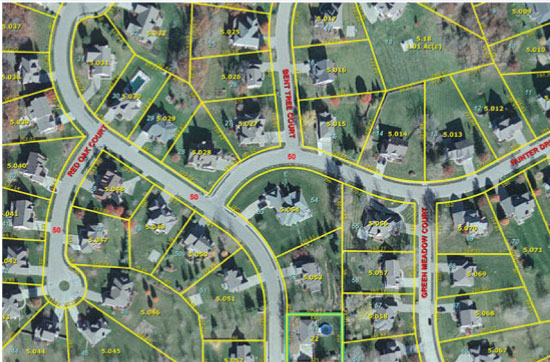
A Land Information & Management System (LIMS) is a comprehensive, technology-driven platform designed to collect, store, manage, and analyze data related to land resources. LIMS integrates various aspects of land administration, including ownership, use, value, and development, enabling efficient and transparent management of land assets.
Service Scope:
- Comprehensive Data Management: Collecting, storing, and analyzing land-related data, including ownership, use, value, and development.
- GIS-Based Land Information System: Integrating geographic and property data for a unified digital platform.
- Land Administration: Streamlining land acquisition, management, and development processes.
A GIS-based Land Information System will be developed that provides a digital platform to integrate geographic and property data.
Benefits:
- Informed decision-making
- Minimized potential risks
- Optimized outcomes
A comprehensive and transparent approach to land management, ensuring efficient and effective utilization of land assets.
Products and Services:
- Geospatial Data Layers
- Cadastral Maps
- Land Use Maps
- Property Valuation Reports
- Land Registry Records
- Land Dispute Resolution
- Custom GIS Development
- Power BI Dashboards
- WebMIS


